Certification: EADE
Certification Full Name: Esri Certified ArcGIS Desktop Entry
Certification Provider: Esri
Exam Code: EADE105
Exam Name: ArcGIS Desktop Entry 10.5
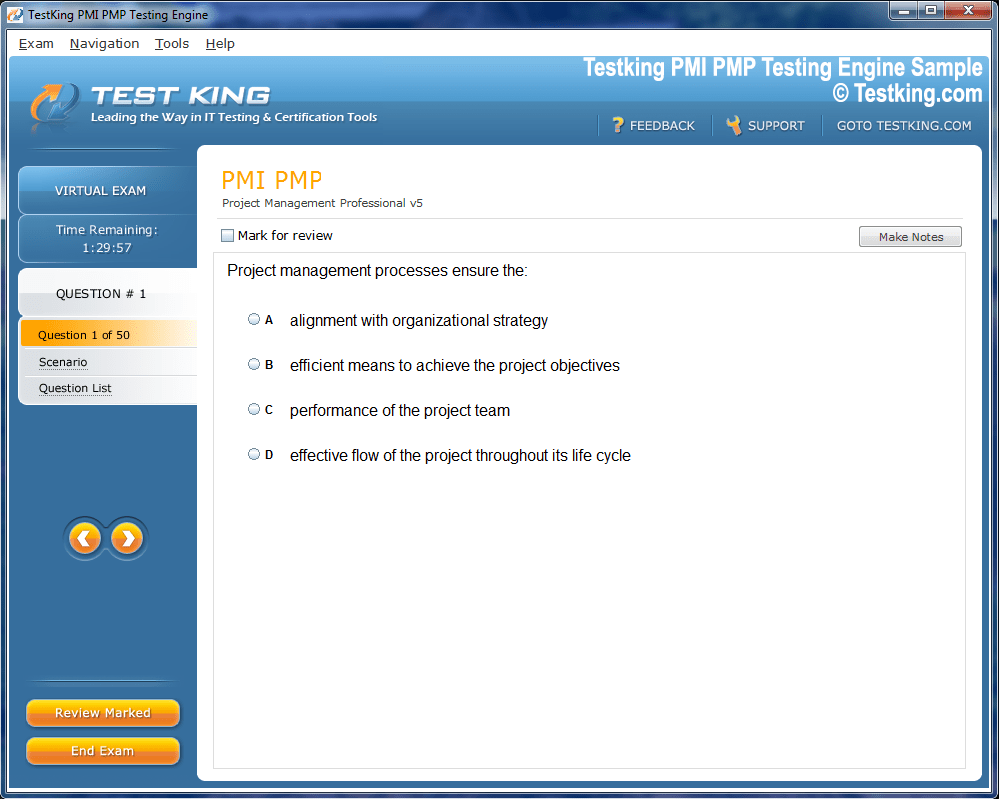
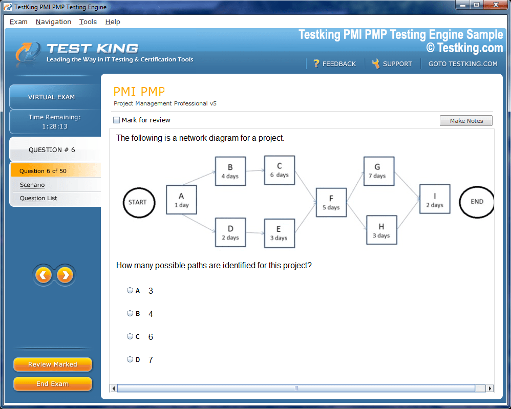
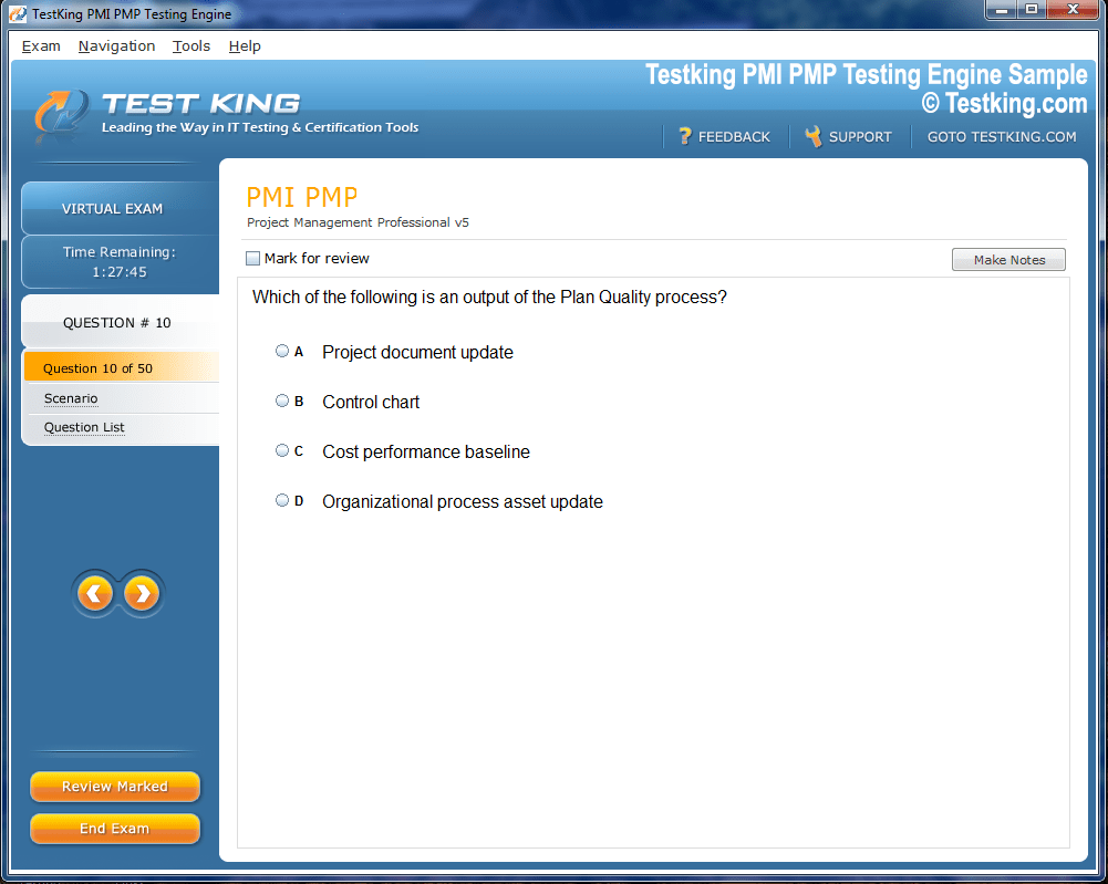
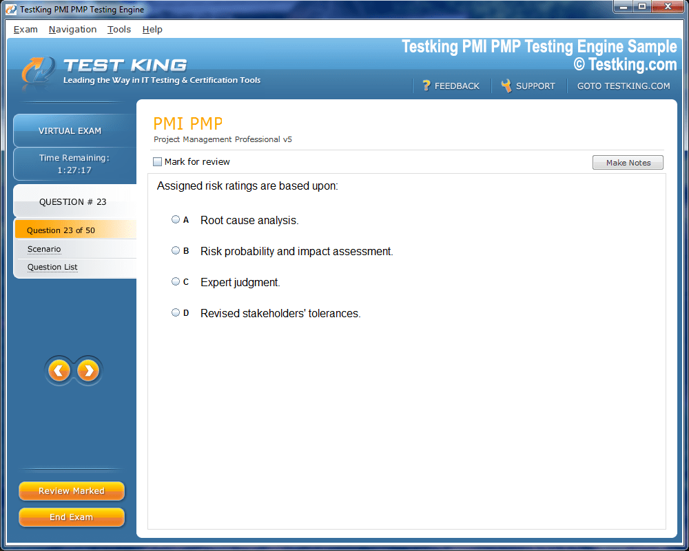
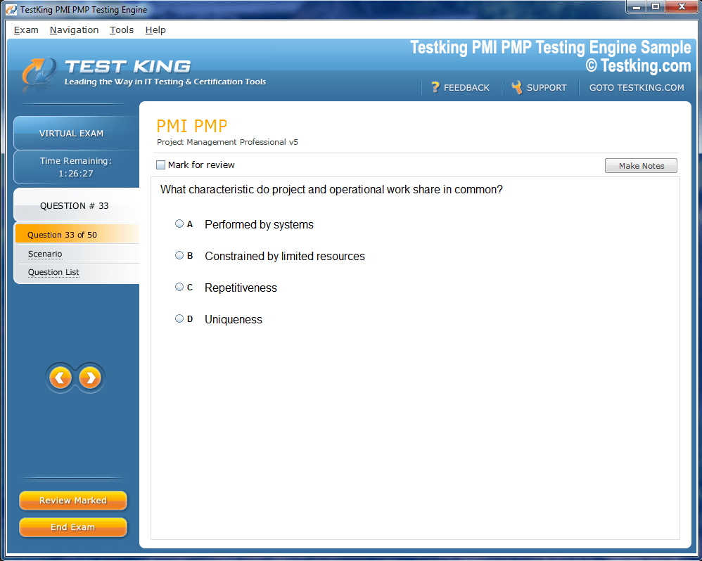
Product Screenshots


nop-1e =1
Developing Proficiency in ArcGIS Desktop with Esri EADE105
Embarking on a journey to master Geographic Information Systems necessitates an intimate acquaintance with the tools and methodologies that constitute the discipline. One such pivotal assessment is the Esri EADE105 Exam, alternatively recognized as the ArcGIS Desktop Entry 10.5 Exam. This examination is meticulously designed to evaluate a candidate's proficiency in navigating, manipulating, and analyzing spatial data using Esri's ArcGIS Desktop software. It is not merely a test of rote memorization; rather, it probes the depth of practical understanding and the ability to apply conceptual frameworks to real-world scenarios. Candidates who aspire to excel in this arena must cultivate both theoretical knowledge and pragmatic dexterity.
The EADE105 Exam encapsulates an array of competencies, encompassing spatial analysis, cartography, geoprocessing, and data management. Spatial analysis involves the intricate interrogation of geographic data to discern patterns, relationships, and trends that are often imperceptible to the untrained eye. Cartography, on the other hand, emphasizes the art and science of map-making, ensuring that visual representations of spatial data convey information accurately, aesthetically, and intelligibly. Geoprocessing is the procedural facet, involving the manipulation and transformation of datasets to derive new insights. Data management underpins all these functions, ensuring that spatial information is organized, retrievable, and consistent.
The EADE105 Exam is structured to present multiple-choice questions interlaced with scenario-based inquiries. These scenarios are designed to simulate challenges encountered in professional GIS environments. The examination spans a duration of two hours, requiring both efficiency and meticulous attention to detail. Achieving the passing threshold of 70 percent is indicative of a competent understanding of the ArcGIS Desktop software and an ability to deploy it effectively in practical contexts.
Proficiency with ArcGIS Desktop
Achieving mastery in ArcGIS Desktop necessitates a methodical approach to familiarization with its myriad tools and functionalities. The software comprises a complex interface, including the Table of Contents, Catalog window, Toolboxes, and map display elements. Acquainting oneself with these components is imperative for efficient navigation and task execution. Each element is designed to facilitate distinct workflows, from data importation and layer management to spatial querying and thematic visualization.
A nuanced comprehension of geodatabases is essential for effective data management. Geodatabases serve as the repository for spatial and attribute data, supporting complex relationships and ensuring data integrity. Feature classes, raster datasets, and tables coexist within these geodatabases, and proficiency in manipulating them is critical. Tasks such as creating, editing, and symbolizing features necessitate familiarity with attribute tables, domain constraints, and topology rules.
Spatial analysis in ArcGIS Desktop is facilitated by a suite of tools within the Spatial Analyst extension. Techniques such as buffering, overlay analysis, and proximity measurement enable the extraction of actionable insights from spatial datasets. Geoprocessing models can automate repetitive tasks, enhancing efficiency and reproducibility. The ModelBuilder tool allows users to construct visual workflows that integrate multiple geoprocessing operations, fostering an understanding of process interdependencies and data transformations.
Cartography within ArcGIS Desktop is both an analytical and aesthetic pursuit. Effective map design requires careful consideration of scale, symbology, labeling, and layout composition. The application of thematic mapping techniques, such as choropleth, proportional symbol, and dot density maps, facilitates the communication of complex spatial phenomena. Mastery of labeling, annotation, and the utilization of map elements like legends and north arrows ensures that the final product is coherent and professional.
Utilizing Esri Training Resources
Esri provides an extensive array of training resources that are invaluable for exam preparation. These resources include guided tutorials, step-by-step exercises, and comprehensive documentation. Engaging with these materials allows candidates to explore functionalities that may not be frequently employed in routine tasks, thereby broadening their operational competence.
Tutorials are structured to incrementally build skills, beginning with foundational concepts and progressing to complex analytical workflows. They often present realistic datasets and scenarios, simulating the type of challenges encountered in professional GIS practice. Documentation serves as a reference compendium, detailing tool parameters, functions, and expected outputs. It is imperative to become conversant with these resources, as they reinforce theoretical understanding and provide practical exemplars.
Practical Experience and Scenario-Based Learning
Hands-on experience is indispensable for success in the EADE105 Exam. Practical exercises cultivate an intuitive understanding of spatial relationships, data behavior, and analytical outcomes. Working with diverse datasets—ranging from vector layers representing geographic features to raster grids capturing environmental variables—enhances problem-solving capabilities. Engaging with real-world scenarios, such as urban planning assessments, environmental impact analyses, or transportation network evaluations, ensures that candidates can apply abstract concepts concretely.
Scenario-based exercises also encourage adaptive thinking. In professional GIS practice, data is seldom pristine; errors, inconsistencies, and missing values are commonplace. Developing strategies to preprocess, clean, and validate datasets is as critical as performing analytical tasks. Exposure to such challenges cultivates resilience and analytical rigor, qualities that are directly evaluated in the EADE105 Exam.
Sample Exams and Self-Assessment
Practicing with sample exams is a strategic method to gauge readiness. These assessments mimic the structure, timing, and content of the actual examination. By engaging with them, candidates can identify areas of strength and weakness, adjust study plans, and refine test-taking strategies. Regular self-assessment promotes familiarity with question types and enhances the ability to interpret complex scenarios efficiently.
During sample exams, time management is of paramount importance. Allocating appropriate time to different sections ensures comprehensive coverage, while leaving room for revisiting challenging questions. The iterative process of practice, review, and correction fosters a disciplined approach to learning and bolsters confidence.
Community Engagement and Knowledge Exchange
Participation in the Esri community and GIS forums provides a collaborative dimension to exam preparation. Engaging with peers and professionals facilitates knowledge exchange, exposure to diverse problem-solving approaches, and clarification of conceptual ambiguities. Discussions regarding best practices, workflow optimization, and novel analytical techniques enrich understanding and reinforce learning.
The collective wisdom of the GIS community can also highlight less commonly known functionalities or shortcuts within ArcGIS Desktop, providing candidates with an edge in efficiency and versatility. Active engagement fosters a sense of professional belonging and cultivates analytical acumen through exposure to varied perspectives.
Staying Current with Software Developments
ArcGIS Desktop is continually evolving, with new versions introducing additional tools, improved functionalities, and refined workflows. Staying abreast of these developments ensures that candidates are familiar with the latest capabilities and modifications that may appear in the exam. Regular consultation of release notes, software updates, and technical bulletins maintains alignment with current industry standards.
Familiarity with new tools or enhancements can streamline analytical processes and expand the repertoire of strategies available to address complex GIS tasks. Awareness of updates also demonstrates adaptability, a critical attribute in both the examination context and professional GIS practice.
Time Management Strategies
Effective time management during the EADE105 Exam is a decisive factor in performance. Candidates must balance speed with accuracy, ensuring that each question is approached methodically. Reading each question carefully, interpreting scenario details, and planning responses strategically minimizes errors and maximizes efficiency.
When encountering particularly challenging questions, candidates benefit from an approach that prioritizes progression over perfection. Making an educated estimation and proceeding allows for completion of the examination within the allocated timeframe, with the opportunity to revisit unresolved items if time permits.
Psychological Preparedness and Confidence
A candidate's mental and physical state significantly influences exam performance. Adequate rest, nutrition, and stress management practices contribute to cognitive clarity and focus. Confidence derived from structured preparation and practical experience reinforces composure, enabling candidates to approach questions analytically and systematically.
Positive mental conditioning, including visualization of successful outcomes and the cultivation of resilience in the face of challenging scenarios, can mitigate anxiety. Psychological preparedness complements technical proficiency, creating a holistic readiness that enhances overall performance.
Integration of Knowledge and Practical Skills
The synthesis of theoretical understanding and practical application is the hallmark of effective preparation for the EADE105 Exam. Knowledge of spatial concepts, analytical techniques, and cartographic principles must be seamlessly integrated with hands-on competence in ArcGIS Desktop. This integration allows candidates to approach complex problems methodically, employ appropriate tools, and derive accurate, insightful results.
Through iterative practice, exposure to diverse scenarios, and continuous refinement of skills, candidates cultivate a comprehensive, adaptable proficiency. This holistic preparation not only facilitates success in the examination but also establishes a solid foundation for professional practice in GIS.
Exploring Spatial Analysis in ArcGIS Desktop
Spatial analysis is a cornerstone of Geographic Information Systems, demanding not only technical competence but also analytical perspicacity. Within the ArcGIS Desktop environment, spatial analysis encompasses a spectrum of operations designed to extract meaningful patterns and relationships from geospatial data. These operations include, but are not limited to, overlay analysis, proximity evaluation, surface analysis, and statistical interrogation of spatial datasets. For candidates preparing for the EADE105 Exam, mastery of these analytical methodologies is indispensable, as the examination frequently presents scenarios that necessitate the application of spatial reasoning to solve complex problems.
Overlay analysis constitutes a fundamental operation in GIS, enabling the juxtaposition of multiple layers to discern intersections, unions, or differences between spatial features. This technique is essential for decision-making processes in urban planning, environmental assessment, and resource management. In ArcGIS Desktop, tools such as Union, Intersect, and Erase facilitate these operations, permitting candidates to manipulate vector datasets with precision. Understanding the nuances of input datasets, attribute preservation, and output feature creation is critical to obtaining accurate and meaningful results.
Proximity analysis, another vital facet of spatial interrogation, involves evaluating distances between geographic features. Techniques such as buffering, nearest neighbor calculation, and spatial join operations allow for the assessment of influence zones, accessibility, and spatial correlation. Buffers, for example, delineate areas of influence around point, line, or polygon features and are integral to environmental modeling, hazard assessment, and service area delineation. Mastery of these operations equips candidates with the ability to derive actionable insights from spatial data, enhancing both analytical capability and decision-making acumen.
Surface analysis extends the analytical repertoire to the third dimension, facilitating the examination of elevation, slope, aspect, and other topographical characteristics. Raster datasets serve as the primary medium for such analyses, and tools within the Spatial Analyst extension allow for the calculation of surface derivatives and the modeling of terrain phenomena. Applications include watershed delineation, viewshed analysis, and suitability modeling, each requiring a nuanced understanding of both the data and the tools. Candidates must be proficient in selecting appropriate input layers, applying analytical functions judiciously, and interpreting results in context.
Statistical analysis within ArcGIS Desktop integrates spatial and attribute data to reveal correlations, trends, and anomalies. Techniques such as spatial autocorrelation, hot spot analysis, and density estimation enable the quantitative evaluation of geographic phenomena. The application of these methods requires familiarity with both the mathematical underpinnings and the software functionalities that execute them. Competence in statistical interpretation enhances the candidate’s capacity to derive meaningful conclusions and supports evidence-based decision-making in professional GIS practice.
Cartographic Principles and Map Design
Cartography, the art and science of map-making, represents another critical domain for the EADE105 Exam. Effective cartographic design requires the synthesis of aesthetic sensibility, spatial literacy, and technical proficiency. In ArcGIS Desktop, candidates must demonstrate the ability to construct maps that convey complex spatial information clearly, accurately, and persuasively.
Fundamental cartographic principles include scale, projection, symbology, and generalization. Scale determines the level of detail represented and influences the selection of appropriate data and symbology. Projections, which translate the curved surface of the Earth onto a two-dimensional plane, must be chosen carefully to minimize distortion and maintain spatial fidelity. Symbology, encompassing color schemes, line weights, and marker styles, communicates thematic information effectively, while generalization ensures that maps remain legible and interpretable at varying levels of detail.
Thematic mapping techniques are essential for representing specific phenomena or patterns. Choropleth maps depict data intensity through graduated color schemes, proportional symbol maps represent quantitative differences using symbol size, and dot density maps illustrate distribution patterns. Each technique demands careful consideration of data classification, symbolization, and legend design to ensure clarity and interpretability. Mastery of these techniques enables candidates to create maps that are not only visually compelling but also analytically informative.
Map layout and composition are equally important, encompassing elements such as titles, legends, scale bars, north arrows, and inset maps. Effective layout design ensures that the map communicates its intended message succinctly while maintaining aesthetic balance. Candidates must understand the interplay between map elements, the visual hierarchy of information, and the cognitive load imposed on the map reader. Proficiency in these aspects reflects a comprehensive understanding of cartographic practice and is vital for successful performance on the EADE105 Exam.
Data Management and Geodatabase Proficiency
A robust understanding of data management is fundamental to all GIS operations. ArcGIS Desktop relies on organized and structured datasets to ensure accuracy, consistency, and reproducibility. Geodatabases serve as the central repository for spatial and attribute data, supporting complex relationships, topology rules, and versioning workflows.
Feature classes, raster datasets, and tables coexist within a geodatabase, each with specific characteristics and constraints. Candidates must demonstrate proficiency in creating, editing, and managing these elements. Attribute tables must be meticulously maintained, with appropriate domains, subtypes, and relationships applied to ensure data integrity. Understanding indexing, query optimization, and data validation processes further enhances the candidate’s capacity to manage large and complex datasets efficiently.
Topology rules, which govern spatial relationships between features, are essential for maintaining geometric integrity. Rules such as must not overlap, must be covered by, and must not have gaps, ensure that datasets are logically consistent and suitable for analysis. Candidates preparing for the EADE105 Exam must be capable of implementing, validating, and troubleshooting topology to produce high-quality spatial data.
Versioning and replication techniques allow for collaborative editing and data distribution across multiple workspaces. These processes are integral to professional GIS practice and enhance the candidate’s ability to manage multi-user environments. Familiarity with these workflows contributes to a deeper understanding of data stewardship and operational efficiency.
Leveraging Esri Resources for Skill Enhancement
Esri offers an extensive suite of learning materials designed to augment practical experience with ArcGIS Desktop. Comprehensive tutorials, step-by-step exercises, and detailed documentation facilitate progressive skill acquisition. Candidates are encouraged to engage with these resources systematically, beginning with foundational concepts and advancing to complex workflows and scenario-based exercises.
Tutorials often incorporate real-world datasets, simulating challenges encountered in professional practice. By completing these exercises, candidates develop both technical proficiency and analytical judgment. Documentation serves as an indispensable reference, detailing tool parameters, expected outputs, and methodological considerations. Mastery of these resources ensures a well-rounded understanding of the software and its practical applications.
Scenario-Based Practice and Problem Solving
Practical experience with scenario-based exercises is pivotal in developing analytical agility. Real-world GIS problems often involve incomplete, inconsistent, or heterogeneous data, requiring candidates to apply critical thinking, preprocessing techniques, and analytical workflows judiciously. Working on urban planning projects, environmental assessments, or transportation network analyses fosters adaptability and hones problem-solving acumen.
Candidates must cultivate strategies for data cleaning, validation, and transformation, as these processes directly impact analytical outcomes. Scenario-based practice also encourages the development of efficient workflows, the integration of multiple analytical tools, and the synthesis of results into coherent conclusions. This practical expertise is directly transferable to the EADE105 Exam, where scenario-based questions assess the ability to apply knowledge in realistic contexts.
Sample Exams and Time Management
Engaging with sample exams is an effective strategy to measure readiness and reinforce learning. These assessments emulate the structure, content, and timing of the actual examination, enabling candidates to familiarize themselves with question types and pacing. Repeated practice facilitates recognition of common question patterns, highlights areas requiring additional focus, and strengthens confidence.
Time management during the exam is crucial. Candidates must allocate time judiciously, ensuring completion of all sections while leaving space to revisit challenging questions. Prioritizing questions based on familiarity and complexity enhances efficiency, while iterative review allows for correction and refinement of responses. Systematic time allocation is integral to achieving optimal performance.
Community Engagement and Collaborative Learning
Participation in the Esri community and professional forums enhances preparation through collaborative knowledge exchange. Engaging with peers and experts provides insights into diverse analytical approaches, clarifies conceptual ambiguities, and introduces practical tips and shortcuts within ArcGIS Desktop. Exposure to varied perspectives fosters analytical flexibility and deepens comprehension.
Collaborative learning also cultivates professional acumen, as candidates observe and emulate best practices, workflow optimization strategies, and effective problem-solving methodologies. The communal exchange of knowledge reinforces theoretical understanding while providing practical guidance applicable to both exam scenarios and professional GIS practice.
Psychological Preparedness and Exam Readiness
Mental fortitude and physical well-being are critical determinants of exam performance. Adequate rest, nutritional balance, and stress management practices contribute to cognitive clarity, focus, and resilience. Confidence derived from structured preparation and practical engagement enhances composure, enabling candidates to approach questions analytically and methodically.
Visualization techniques, positive reinforcement, and mindfulness practices can mitigate anxiety and bolster concentration. Psychological preparedness complements technical proficiency, forming a holistic approach to exam readiness that maximizes performance potential.
Integration of Analytical Skills and Technical Competence
The EADE105 Exam requires the seamless integration of analytical insight and technical competence. Candidates must synthesize spatial reasoning, cartographic principles, and data management skills within the ArcGIS Desktop environment to address complex problems effectively. Iterative practice, exposure to diverse datasets, and scenario-based learning cultivate adaptability, precision, and efficiency.
By developing a cohesive skill set that combines theory, practical application, and critical thinking, candidates position themselves to achieve success on the examination. This integrated expertise not only facilitates passing the exam but also lays a strong foundation for professional practice in GIS.
Mastering Geoprocessing in ArcGIS Desktop
Geoprocessing serves as a fundamental pillar in the realm of Geographic Information Systems, facilitating the transformation, analysis, and synthesis of spatial data. In the ArcGIS Desktop environment, geoprocessing encompasses a suite of tools and workflows designed to automate tasks, streamline data manipulation, and generate actionable insights. Candidates preparing for the EADE105 Exam must develop a thorough understanding of geoprocessing operations, as these form the backbone of scenario-based problem solving within the assessment.
Geoprocessing tools are organized into toolboxes, each tailored to specific categories of operations, including analysis, data management, conversion, and spatial statistics. The execution of these tools requires careful selection of input datasets, configuration of parameters, and interpretation of outputs. Competence in geoprocessing not only enhances analytical efficiency but also ensures reproducibility and accuracy in spatial data workflows.
One of the most versatile aspects of geoprocessing is the ability to create models that automate complex sequences of operations. ArcGIS Desktop provides the ModelBuilder tool, which allows users to construct visual representations of workflows by linking multiple geoprocessing tools. ModelBuilder facilitates the execution of repetitive tasks, supports scenario testing, and provides a framework for understanding the interdependencies among datasets and processes. Proficiency in ModelBuilder is a significant advantage for candidates, as it demonstrates the ability to orchestrate sophisticated spatial analyses efficiently.
Raster and Vector Data Manipulation
A comprehensive grasp of raster and vector data manipulation is essential for geoprocessing tasks. Vector data, composed of points, lines, and polygons, is particularly suited for discrete feature representation, while raster data excels in continuous surface analysis. Candidates must be adept at converting between these data types, performing overlay operations, and applying spatial transformations to derive meaningful results.
Raster analysis often involves operations such as map algebra, reclassification, and neighborhood analysis. Map algebra allows for the application of mathematical functions to raster datasets, facilitating the derivation of indices, suitability surfaces, or environmental models. Reclassification simplifies data by grouping values into meaningful categories, enhancing interpretability and analytical clarity. Neighborhood analysis, including focal statistics, examines the characteristics of a raster cell in relation to its surrounding cells, enabling the detection of local patterns and anomalies.
Vector data manipulation includes buffering, clipping, dissolving, and intersecting features. Buffering generates zones of influence around spatial entities, supporting proximity assessments and impact analysis. Clipping isolates specific areas of interest from larger datasets, facilitating targeted analysis. Dissolve operations aggregate features based on shared attributes, streamlining data representation, while intersect operations identify spatial overlap between multiple layers, providing insights into relational dynamics.
Workflow Optimization and Efficiency
Efficiency in geoprocessing is not solely a function of technical proficiency but also of workflow optimization. Candidates must cultivate an understanding of task sequencing, data dependencies, and resource management. The execution of geoprocessing operations in a logical, streamlined order minimizes computational load and reduces the potential for errors.
Iterative testing of workflows is essential to ensure accuracy and reliability. Candidates should adopt a methodical approach, validating outputs at each stage and adjusting parameters as necessary. This iterative refinement enhances confidence in analytical outcomes and prepares candidates to address the multifaceted scenarios encountered in the EADE105 Exam.
Automation through scripting further augments workflow efficiency. ArcGIS Desktop supports Python scripting via the ArcPy module, enabling the creation of custom scripts to perform repetitive or complex operations. Familiarity with scripting principles allows candidates to extend the functionality of built-in tools, integrate external datasets, and implement tailored solutions for specialized analytical challenges.
Data Quality and Validation
High-quality data underpins all geoprocessing operations, making data validation a critical preparatory focus for the EADE105 Exam. Candidates must be adept at identifying and rectifying errors, inconsistencies, and missing values within datasets. Topology rules, attribute validation, and spatial integrity checks ensure that analyses are grounded in reliable information.
Topological consistency is particularly important for vector datasets, as spatial relationships such as adjacency, connectivity, and containment must adhere to logical constraints. Violations of topology rules can propagate errors through geoprocessing workflows, leading to inaccurate or misleading results. Understanding and applying these principles is essential for both exam success and professional GIS practice.
Raster datasets also require scrutiny, particularly regarding resolution, extent, and alignment. Misaligned rasters, differing cell sizes, or inconsistent projections can introduce analytical errors. Candidates must be proficient in preprocessing techniques, including resampling, reprojecting, and mosaicking, to prepare datasets for accurate analysis.
Scenario-Based Geoprocessing Exercises
Practical experience with scenario-based geoprocessing is invaluable for building analytical dexterity. Real-world GIS tasks often involve multifaceted problems requiring the integration of multiple tools and datasets. For instance, an environmental impact assessment may necessitate the combination of terrain analysis, hydrological modeling, and land cover evaluation. Engaging with such exercises cultivates the ability to orchestrate complex workflows and adapt analytical strategies to diverse datasets.
Scenario-based practice also encourages problem decomposition, where large tasks are broken into manageable components. Candidates develop strategies for sequencing operations, validating intermediate outputs, and synthesizing final results. This structured approach mirrors the analytical demands of the EADE105 Exam, ensuring that candidates are equipped to handle intricate scenarios efficiently.
Time Management and Exam Strategy
Effective time management during geoprocessing questions is pivotal. Candidates must balance the need for thorough analysis with the constraints of the examination timeframe. Prioritizing tasks based on familiarity, complexity, and potential impact allows for optimal allocation of time. When encountering challenging operations, it is often strategic to proceed with an estimated solution and revisit the task later if time permits.
Familiarity with common geoprocessing workflows accelerates task execution. By internalizing standard sequences, candidates can navigate the software interface more efficiently, reduce cognitive load, and allocate more attention to analytical reasoning. This combination of technical fluency and strategic planning is essential for maximizing performance.
Integration with Spatial Analysis and Cartography
Geoprocessing does not exist in isolation; it interfaces seamlessly with spatial analysis and cartographic presentation. Outputs from geoprocessing operations serve as inputs for further analysis, enabling iterative exploration of spatial phenomena. For example, the result of a buffering operation may feed into a suitability analysis, while the output of an overlay operation may be visualized using thematic mapping techniques.
Understanding the interplay between geoprocessing, analysis, and cartography enhances the interpretability and utility of results. Candidates must develop the ability to translate analytical outputs into coherent visual representations, ensuring that insights are communicated effectively. This integration underscores the holistic nature of GIS practice, where analytical rigor and visual clarity are mutually reinforcing.
Leveraging Esri Resources for Geoprocessing Mastery
Esri provides a wealth of resources specifically tailored to geoprocessing skill development. Tutorials, tool documentation, and example datasets offer structured pathways for mastering both fundamental and advanced operations. Engaging with these materials systematically allows candidates to explore complex workflows, experiment with diverse tools, and gain familiarity with parameter configurations.
Documentation serves as an essential reference, detailing tool capabilities, input requirements, and expected outputs. Understanding these specifications enables candidates to anticipate the behavior of geoprocessing tools, troubleshoot errors, and optimize analytical strategies. This preparation ensures that candidates approach the EADE105 Exam with both confidence and competence.
Community Engagement and Knowledge Exchange
Participation in professional GIS communities enriches geoprocessing proficiency. Engaging with peers and experts provides exposure to alternative approaches, innovative techniques, and best practices. Discussions regarding workflow optimization, tool selection, and data management strategies offer practical insights that complement theoretical knowledge.
Community engagement also fosters adaptive thinking, as candidates are introduced to diverse problem-solving methodologies and unconventional solutions. This exposure enhances analytical flexibility, enabling candidates to approach unfamiliar scenarios with creativity and confidence.
Psychological Preparedness and Confidence
The cognitive demands of geoprocessing questions necessitate mental clarity and composure. Adequate rest, nutrition, and stress management practices support focus, attention to detail, and problem-solving acuity. Confidence derived from systematic preparation and hands-on experience reinforces composure during the examination, facilitating deliberate and effective decision-making.
Visualization techniques, positive self-talk, and structured review routines contribute to psychological readiness. By cultivating a mindset of resilience and preparedness, candidates can navigate complex geoprocessing scenarios with poise, maximizing their potential for success.
Synthesis of Knowledge and Technical Skills
Mastery of geoprocessing requires the integration of theoretical understanding, technical proficiency, and analytical judgment. Candidates must synthesize knowledge of spatial operations, data management, and analytical workflows to address multifaceted GIS challenges effectively. Iterative practice, scenario-based exercises, and engagement with diverse datasets cultivate this integration, resulting in both competence and confidence.
This holistic approach ensures that candidates are not only prepared to execute geoprocessing tasks accurately but also equipped to interpret results critically, derive meaningful insights, and communicate findings effectively. Such integration of skills embodies the essence of GIS expertise and forms the foundation for both exam success and professional practice.
Effective Map Design and Cartographic Techniques
Cartography represents a vital intersection between science, art, and communication in Geographic Information Systems. Within the ArcGIS Desktop environment, the creation of compelling and accurate maps requires both technical dexterity and an appreciation for visual semantics. Candidates preparing for the EADE105 Exam must develop a comprehensive understanding of cartographic principles, as exam scenarios often demand the synthesis of analytical results into coherent and intelligible visual representations.
At the foundation of map design lies the concept of scale, which determines the granularity of spatial information and influences the choice of symbolization and detail. Large-scale maps provide fine-grained detail suitable for localized studies, whereas small-scale maps emphasize broader spatial patterns. Candidates must be adept at selecting scales that align with the purpose of the map and the nature of the data, ensuring that spatial relationships are represented faithfully and meaningfully.
Projection selection constitutes another critical aspect of cartographic precision. Map projections translate the three-dimensional surface of the Earth into a two-dimensional representation, inevitably introducing distortions in area, shape, distance, or direction. Understanding the trade-offs associated with various projections allows candidates to choose the most appropriate one for a given analytical or presentation task, thereby preserving the integrity of spatial relationships.
Symbology, encompassing colors, line styles, and marker types, conveys thematic meaning and supports data interpretation. Graduated color schemes, proportional symbols, and dot density techniques each serve distinct purposes, enabling the effective communication of quantitative and qualitative patterns. Candidates must develop an intuitive sense of visual hierarchy, ensuring that the most salient information is readily apparent while maintaining aesthetic balance and clarity.
Labeling and annotation further enhance map readability. ArcGIS Desktop provides tools to automate labeling while allowing for manual adjustments to resolve overlaps and improve visual coherence. Understanding typographic principles, including font selection, size, and placement, contributes to the legibility and interpretability of the final map product. Attention to these details ensures that the map communicates its message effectively without overwhelming or confusing the reader.
Map layout design integrates individual map elements into a cohesive composition. Essential components include the title, legend, scale bar, north arrow, and inset maps. Effective layout design balances functional clarity with visual appeal, guiding the reader’s attention and facilitating comprehension. Candidates must be proficient in arranging these elements, optimizing space utilization, and maintaining a logical flow of information. This proficiency demonstrates not only technical skill but also an understanding of the cognitive principles underlying map interpretation.
Thematic Mapping and Data Visualization
Thematic mapping constitutes a central technique for communicating spatial phenomena. Choropleth maps, which utilize graduated colors to depict quantitative differences across polygons, enable the visualization of intensity or density patterns. Proportional symbol maps convey magnitude through symbol size, while dot density maps illustrate distribution and concentration. Mastery of these techniques requires careful consideration of classification methods, symbol scaling, and color selection to avoid misrepresentation or misinterpretation of data.
Visualization extends beyond static maps to include dynamic and interactive representations. Although ArcGIS Desktop primarily supports static outputs for exam purposes, candidates who are familiar with dynamic visualization concepts gain a deeper appreciation for the communicative potential of spatial data. Techniques such as transparency adjustment, layer blending, and advanced symbology allow for nuanced visual storytelling, emphasizing key patterns while minimizing visual clutter.
Integration of Analytical Outputs into Cartography
Cartography in ArcGIS Desktop is inherently linked to spatial analysis and geoprocessing. Analytical outputs, such as buffered zones, suitability models, or raster-derived indices, must be translated into visually coherent maps. Candidates must be adept at selecting appropriate symbology, defining classification schemes, and incorporating relevant contextual layers. This integration ensures that the analytical narrative is preserved and effectively communicated to the map reader.
Understanding the interplay between data complexity and visual simplicity is critical. Excessive detail or inappropriate symbolization can obscure the underlying patterns, while oversimplification may omit essential insights. Candidates must strike a balance, ensuring that maps convey information accurately, efficiently, and aesthetically. This capacity for judicious synthesis is indicative of both analytical sophistication and cartographic acumen.
Data Management and Workflow Efficiency
Effective cartographic production relies on well-managed datasets and efficient workflows. Candidates must demonstrate proficiency in organizing layers, maintaining consistent attribute tables, and managing geodatabase structures. Structured data management minimizes errors, facilitates reproducibility, and supports the iterative refinement of map products. Geoprocessing outputs must be carefully integrated, with attention to projection consistency, data alignment, and attribute integrity.
Workflow efficiency is enhanced through the use of templates, style libraries, and pre-configured layouts. These tools standardize processes, reduce redundancy, and allow candidates to focus on analytical and visual refinement. Familiarity with such techniques ensures that candidates can produce high-quality maps within the constraints of the EADE105 Exam timeframe, reflecting both technical competence and strategic planning.
Scenario-Based Cartographic Exercises
Practical exercises are essential for developing cartographic proficiency. Candidates should engage with scenario-based tasks that simulate real-world mapping challenges, such as urban planning, environmental assessment, or transportation network visualization. These exercises cultivate the ability to synthesize analytical results, select appropriate visualization techniques, and produce coherent map layouts.
Scenario-based practice also fosters problem-solving skills, as candidates encounter incomplete datasets, complex spatial relationships, and diverse visualization requirements. Developing strategies to address these challenges enhances adaptability, critical thinking, and precision—qualities directly assessed in the EADE105 Exam.
Sample Exams and Self-Evaluation
Practicing with sample exams provides a structured method for assessing cartographic readiness. These assessments replicate the format, content, and timing of the actual examination, allowing candidates to identify strengths, weaknesses, and areas requiring further study. Iterative engagement with sample exams promotes familiarity with question types, enhances time management skills, and reinforces conceptual understanding.
Self-evaluation is a critical component of exam preparation. Candidates should analyze their performance, review errors, and refine strategies for approaching similar tasks in the future. This reflective practice fosters continuous improvement, ensuring that preparation is both targeted and effective.
Community Engagement and Knowledge Sharing
Engagement with the Esri community and professional forums enriches cartographic expertise. Collaborative discussion exposes candidates to alternative visualization techniques, best practices in map design, and innovative approaches to problem-solving. Sharing knowledge and receiving feedback enhances understanding and reinforces learning.
Community interaction also encourages exposure to uncommon or advanced cartographic methodologies, broadening the candidate’s skill set and fostering analytical versatility. This collaborative dimension complements individual practice, cultivating both technical proficiency and creative insight.
Staying Current with Cartographic Trends
ArcGIS Desktop evolves continuously, introducing new tools, symbology options, and layout capabilities. Staying informed about these updates ensures that candidates are familiar with current functionalities and can leverage them effectively in the examination. Regular consultation of software release notes and technical bulletins maintains alignment with contemporary standards and practices.
Awareness of emerging cartographic conventions, color theory applications, and visual analytics principles further enhances map quality. Candidates who integrate these insights demonstrate both technical mastery and professional sophistication, positioning themselves for success on the EADE105 Exam and in GIS practice more broadly.
Time Management and Strategic Execution
Cartographic questions in the EADE105 Exam demand careful time allocation. Candidates must balance the need for visual refinement with analytical accuracy, ensuring that maps are both precise and presentable. Prioritizing tasks based on complexity, familiarity, and impact enables efficient workflow, while iterative review of layouts ensures quality and consistency.
Familiarity with common map production workflows accelerates task completion, reduces cognitive load, and allows candidates to devote more attention to analytical judgment. This combination of speed, accuracy, and visual discernment is essential for achieving optimal performance.
Psychological Preparedness and Confidence
Effective map creation requires sustained focus and cognitive clarity. Adequate rest, nutritional balance, and stress management contribute to attention, problem-solving ability, and composure. Confidence derived from structured preparation and extensive practice reinforces performance, enabling candidates to navigate complex cartographic challenges with poise.
Visualization of successful task completion, positive self-talk, and iterative practice support psychological readiness, reducing anxiety and fostering a sense of control. These practices complement technical proficiency, creating a holistic approach to exam preparedness.
Integration of Cartographic Skills with Analytical Competence
Cartography is most effective when integrated with spatial analysis and geoprocessing outputs. Candidates must synthesize map design principles with analytical results, producing representations that are both visually coherent and analytically accurate. This integration underscores the interdependence of technical skill, analytical reasoning, and visual communication.
By developing the capacity to translate complex spatial analyses into clear, informative maps, candidates demonstrate a comprehensive understanding of GIS workflows. This ability not only supports examination success but also establishes a foundation for professional practice, where effective communication of spatial insights is paramount.
Exam Preparation Strategies for the EADE105
Achieving success in the Esri EADE105 Exam necessitates a systematic, disciplined, and multifaceted preparation approach. While technical proficiency in ArcGIS Desktop forms the core of readiness, effective strategies encompass time management, resource utilization, practical exercises, psychological preparedness, and iterative review. Candidates must cultivate both cognitive and procedural agility to navigate the exam efficiently, particularly when confronted with scenario-based questions demanding analytical reasoning and decision-making precision.
Structured preparation begins with an evaluation of the candidate’s current skill set, identifying areas of strength and those requiring reinforcement. A self-assessment can highlight gaps in knowledge, familiarity with tools, or comfort with analytical workflows. By establishing a personalized study plan that prioritizes weak points while consolidating strengths, candidates create a roadmap that maximizes efficiency and focus during preparation.
Leveraging Learning Resources
Esri provides an extensive array of learning resources designed to facilitate mastery of ArcGIS Desktop. Tutorials, step-by-step exercises, and comprehensive documentation offer structured opportunities to explore functionalities and reinforce conceptual understanding. Candidates should engage with these materials iteratively, beginning with foundational exercises and progressing to complex, scenario-based workflows. This layered approach promotes deep comprehension while ensuring that technical competence is systematically developed.
Supplementing formal resources with scenario-based exercises enhances analytical adaptability. Real-world projects—ranging from environmental assessments and urban planning analyses to transportation network evaluations—cultivate practical problem-solving skills. By confronting data irregularities, spatial anomalies, and analytical complexity, candidates develop resilience and proficiency in applying tools under realistic conditions.
Practical Exercises and Scenario-Based Learning
Hands-on engagement with GIS datasets is essential for reinforcing technical skills. Working with diverse data types—raster, vector, tabular, and geodatabase structures—exposes candidates to the operational challenges encountered in professional practice. Scenario-based learning encourages decomposition of complex problems, sequential task execution, and synthesis of results into coherent outputs.
Candidates should focus on iterative refinement of workflows, testing geoprocessing operations, validating outputs, and ensuring reproducibility. This iterative approach fosters both precision and efficiency, qualities directly assessed in the EADE105 Exam. Scenario-based practice also strengthens critical thinking, enabling candidates to make informed decisions under time constraints.
Sample Exams and Self-Assessment
Engaging with sample exams replicates the structure, timing, and content of the actual EADE105 examination, offering a valuable opportunity for self-assessment and performance optimization. Repeated practice with these simulated tests develops familiarity with question formats, enhances time management skills, and allows candidates to identify areas for targeted review.
Systematic analysis of errors is equally important. By understanding the reasoning behind incorrect responses, candidates refine their conceptual understanding and avoid repeating mistakes. Iterative engagement with sample exams cultivates confidence, reinforces technical knowledge, and ensures that candidates approach the examination with strategic acumen.
Time Management Techniques
Effective time management is critical during the EADE105 Exam. Candidates must balance the need for careful analysis with the constraints of the examination timeframe. Prioritizing tasks based on familiarity, complexity, and potential impact ensures comprehensive coverage while minimizing the risk of omissions.
Strategic approaches include reading each question thoroughly, allocating initial time estimates, and leaving complex or uncertain items for subsequent review. Candidates who maintain awareness of time progression and adjust pacing accordingly are better equipped to navigate the examination efficiently, maximizing accuracy and completeness.
Psychological Readiness and Focus
Cognitive clarity and composure are essential for optimal performance. Adequate rest, nutritional balance, and stress management practices enhance focus, attention to detail, and problem-solving capacity. Candidates should cultivate a mindset of preparedness, drawing confidence from structured practice and iterative review.
Visualization techniques, positive reinforcement, and mental rehearsal can mitigate anxiety, improve concentration, and reinforce analytical strategies. Psychological readiness complements technical skill, enabling candidates to approach each question systematically, maintain composure under pressure, and execute tasks with precision.
Integration of Knowledge and Skills
The EADE105 Exam evaluates the integration of multiple competencies, including spatial analysis, geoprocessing, cartography, and data management. Candidates must synthesize conceptual knowledge with technical execution, translating analytical results into coherent maps, validated datasets, and actionable insights.
Iterative practice with complex scenarios enhances this integration, fostering adaptive thinking, workflow optimization, and analytical resilience. Candidates develop the ability to approach problems methodically, select appropriate tools, and interpret results critically. This holistic skill set forms the foundation for both examination success and professional practice in Geographic Information Systems.
Community Engagement and Collaborative Learning
Participation in the Esri community and professional forums enriches preparation through knowledge exchange and collaborative learning. Engaging with peers, experts, and practitioners exposes candidates to alternative methodologies, innovative workflows, and best practices. Discussions regarding tool selection, analytical strategies, and cartographic techniques provide practical insights that complement individual study.
Collaborative learning also fosters adaptability, as candidates encounter diverse problem-solving approaches and develop the capacity to respond flexibly to unfamiliar scenarios. Exposure to community expertise reinforces conceptual understanding, enhances technical competence, and cultivates a professional mindset aligned with GIS practice standards.
Continuous Learning and Adaptability
ArcGIS Desktop is a dynamic platform with frequent updates introducing new tools, enhanced functionalities, and refined workflows. Staying current with software developments ensures that candidates are familiar with contemporary capabilities and analytical techniques. Regular consultation of release notes, documentation, and training materials maintains alignment with evolving standards and supports adaptive proficiency.
Continuous learning extends beyond technical updates to include emerging best practices in spatial analysis, cartography, and data management. Candidates who cultivate intellectual curiosity and remain engaged with evolving methodologies develop a versatile skill set, enhancing both examination readiness and long-term professional competence.
Workflow Optimization and Efficiency
Efficiency in examination performance relies not only on technical proficiency but also on the strategic orchestration of workflows. Candidates should develop systematic approaches to task execution, sequencing operations logically, and minimizing redundant steps. Workflow optimization reduces cognitive load, enhances focus, and allows for more deliberate analytical reasoning.
Automation tools, including ModelBuilder and Python scripting via ArcPy, further enhance efficiency. Candidates familiar with these tools can streamline repetitive tasks, integrate complex operations, and execute analytical sequences with precision. Mastery of workflow optimization demonstrates both technical sophistication and strategic planning ability, traits valued in the EADE105 examination context.
Integrating Analytical, Cartographic, and Data Management Skills
A hallmark of EADE105 proficiency is the seamless integration of analytical, cartographic, and data management competencies. Candidates must be capable of performing spatial analyses, executing geoprocessing operations, managing datasets with integrity, and producing visually coherent maps. This integration ensures that results are accurate, interpretable, and actionable.
Scenario-based practice facilitates this synthesis, allowing candidates to navigate complex tasks that mirror professional GIS challenges. By consolidating skills across domains, candidates develop a holistic understanding of GIS workflows, enhancing both examination performance and professional readiness.
Exam Day Strategies
On the day of the examination, preparedness extends beyond technical competence. Candidates should arrive well-rested, nourished, and composed. Maintaining a calm and focused mindset allows for deliberate analysis, effective time management, and strategic decision-making. Confidence in one’s preparation mitigates anxiety, enabling the candidate to approach each question methodically and efficiently.
During the exam, reading questions thoroughly, interpreting scenario details accurately, and verifying outputs are essential. When confronted with challenging items, candidates should employ educated estimation, prioritize progression, and revisit uncertain questions if time permits. This strategy balances accuracy with completion, optimizing overall performance.
Reflection and Iterative Improvement
Post-practice reflection is a critical component of effective preparation. Candidates should review completed exercises, sample exams, and scenario-based tasks to identify patterns of errors, recurring challenges, and areas for further refinement. This iterative process promotes continuous improvement, consolidates learning, and reinforces adaptive problem-solving strategies.
Reflection also cultivates metacognitive awareness, enabling candidates to evaluate their own understanding, recognize knowledge gaps, and adjust study approaches accordingly. This self-directed refinement enhances both technical competence and strategic readiness for the EADE105 Exam.
Conclusion
Preparing for and passing the Esri EADE105 Exam requires a comprehensive approach that blends technical proficiency, analytical acumen, and strategic preparation. Mastery of ArcGIS Desktop, including spatial analysis, geoprocessing, cartography, and data management, forms the foundation for effective problem-solving and scenario-based task execution. Engaging with Esri learning resources, practicing with real-world datasets, and completing sample exams reinforce understanding while cultivating efficiency, adaptability, and confidence. Equally important is the integration of analytical insights with cartographic presentation, ensuring that results are both accurate and visually coherent. Time management, workflow optimization, and psychological readiness further enhance performance, enabling candidates to approach the examination methodically and with composure. By embracing iterative practice, continuous learning, and reflective self-assessment, candidates not only increase their chances of success on the EADE105 Exam but also establish a robust and enduring skill set essential for professional growth in Geographic Information Systems.
Frequently Asked Questions
Where can I download my products after I have completed the purchase?
Your products are available immediately after you have made the payment. You can download them from your Member's Area. Right after your purchase has been confirmed, the website will transfer you to Member's Area. All you will have to do is login and download the products you have purchased to your computer.
How long will my product be valid?
All Testking products are valid for 90 days from the date of purchase. These 90 days also cover updates that may come in during this time. This includes new questions, updates and changes by our editing team and more. These updates will be automatically downloaded to computer to make sure that you get the most updated version of your exam preparation materials.
How can I renew my products after the expiry date? Or do I need to purchase it again?
When your product expires after the 90 days, you don't need to purchase it again. Instead, you should head to your Member's Area, where there is an option of renewing your products with a 30% discount.
Please keep in mind that you need to renew your product to continue using it after the expiry date.
How often do you update the questions?
Testking strives to provide you with the latest questions in every exam pool. Therefore, updates in our exams/questions will depend on the changes provided by original vendors. We update our products as soon as we know of the change introduced, and have it confirmed by our team of experts.
How many computers I can download Testking software on?
You can download your Testking products on the maximum number of 2 (two) computers/devices. To use the software on more than 2 machines, you need to purchase an additional subscription which can be easily done on the website. Please email support@testking.com if you need to use more than 5 (five) computers.
What operating systems are supported by your Testing Engine software?
Our testing engine is supported by all modern Windows editions, Android and iPhone/iPad versions. Mac and IOS versions of the software are now being developed. Please stay tuned for updates if you're interested in Mac and IOS versions of Testking software.